Articles

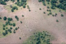
20th c. military fortifications in northern Dobrogea
Public can explore hundreds of new prehistoric, Roman and medieval archaeological sites identified through aerial reconnaissance
The public can explore hundreds of new prehistoric, Roman and medieval sites discovered in Romania by archaeologists using aerial reconnaissance.
Experts from Romania and the UK used light aircrafts to take the thousands of photographs used to identify the sites, around 90 per cent were previously unknown. The images are now available for the public to see on a new website.
The sites date from the Neolithic period to the 20th century, including medieval castles, fortified churches, hill forts, funerary barrows (tumuli) and cemeteries, alongside Roman military bases, villas, legions, towns, villages and temples.
Photographs from 422 sites from south Dobrogea, north Dobrogea and south west Transylvania are already on the website, with more to be added soon. These include the remains of Roman villas and larger settlements in the territories of Sarmizegetusa, Apulum, Kallatis and Tropaeum Traiani, the Roman and late Roman forts at Micia, Cigmau, Razboieni, Ighiu, Macin, Dunareni, Capidava overlooking the Mures or the Danube, a complex of WWI trenches near the Danube NE of Beştepe or a WWII military airfield at Balomiru.The photographs also show Roman-Byzantine forts in rough grazing near the Danube delta, artillery casemates of the late 19th or early 20th century in cultivated fields on the outskirts of Galaţi, a Roman fortlet and earlier fort at Galaţi-Bărboși on the Tirighina promontory overlooking the Siret river. Also found are earthwork defences of a fortification, possibly later prehistoric or medieval, which may have been reused during WWI, on raised ground overlooking the Danube.
The work has helped researchers to learn more about the Roman conquest of the country, and the impact on indigenous communities. Researchers hope their images displayed on the newly launched website will encourage further excavation and investigation on the ground and raise awareness of the archaeological remains in Romania still to be explored.
Dr Ioana Oltean, from the University of Exeter, who led the project, said: “We hope people will enjoy exploring our findings, and that they encourage new investigations or will help people make a case for excavation before infrastructure is built. We hope the database will help to secure archaeological sites for the future, and raise awareness of the incredible history of the region.
“During flights we were looking for unusual landscape patterns, which we would then photograph and analyse. We now have probably the largest collection of reconnaissance archaeological aerial photographs of Romania, showing features now lost because of subsequent development.
“The photographs have helped us to learn more about the nature and impact of the Roman conquest and subsequent colonisation on the transformation of indigenous settlement patterns across Romania. We now hope our work will increase understanding of the history and development of these landscapes, beyond that of the later prehistory to the immediate post-Roman period.”
The research team hope to be able to find more sites in the future using new drone technology and satellite imagery.
The photographs were taken between 1998 and 2015, with the work funded by a Leverhulme Fellowship, European Commission and British Academy. The website was created with help from staff at the University of Exeter’s Digital Humanities Lab, with assistance from student interns.
Date: 30 November 2020
